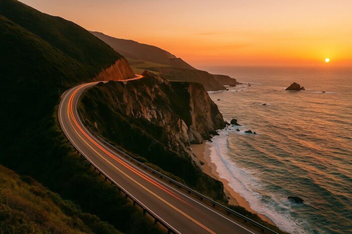
A Pacific Coast Highway road trip is the classic California drive: cliffs dropping into the ocean, arched bridges, beach towns and long stretches where the Pacific fills the view. The most scenic section runs from Carmel through Big Sur and down the Central Coast to Malibu, and it rewards travelers who take it slowly.
This itinerary covers the route from north to south, the best stops, how many days to plan and what to know about road conditions in 2026.
The route: Highway 1 from Carmel to Malibu
California State Route 1 runs 656 miles along the coast. Strictly speaking, only the southern portion, from Oxnard to Dana Point, carries the Pacific Coast Highway name, but most travelers use “PCH” for the whole coastal road. For a Highway 1 road trip, the stretch between Carmel and Malibu holds the best scenery.
Plan to drive north to south. You will be in the lane closest to the ocean, which makes pulling into viewpoints easier and safer.
Highway 1 road status in 2026
Big Sur has seen repeated closures. Highway 1 at Regent’s Slide reopened on January 14, 2026, restoring through traffic between Carmel and Cambria for the first time in almost three years. Parts of the road then closed in summer 2026 because of the Timber and Plaskett fires, and it fully reopened on September 14, 2026. Some state parks along the coast can stay closed after the road reopens. Check Caltrans QuickMap and California State Parks before you leave.
In Malibu, PCH reopened between Santa Monica and Malibu in May 2025 after the Palisades Fire closure, with occasional lane closures for recovery work since.
Stops on a Big Sur to Malibu itinerary
Carmel-by-the-Sea
Start in this small, walkable town next to Monterey. Stock up on gas, snacks and water here: services are limited and pricey through Big Sur.
Bixby Bridge
Roughly 15 miles south of Carmel, this 1932 concrete arch bridge is one of the most photographed spots on the coast. Use the pullouts rather than stopping on the road.
Big Sur and McWay Falls
The Big Sur coast stretches roughly 90 miles from Carmel to San Simeon. In Julia Pfeiffer Burns State Park, a short walk leads to McWay Falls, an 80-foot waterfall that drops toward the beach and ocean. Check that the park is open before you go.
Piedras Blancas elephant seals
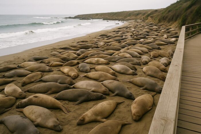
North of San Simeon, a free viewing area with a boardwalk overlooks the largest elephant seal rookery on the West Coast. It is open year-round, and volunteer docents are often on hand to explain what you are seeing.
San Simeon, Cambria and Morro Bay
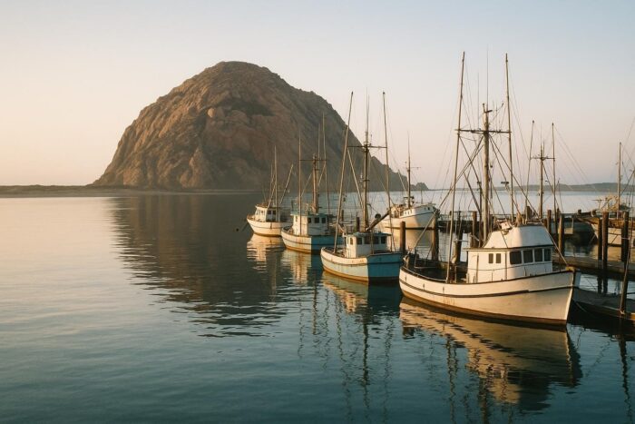
Hearst Castle sits on the hill above San Simeon. Cambria is a pleasant overnight stop with a seaside boardwalk, and Morro Bay is known for Morro Rock at the harbor mouth.
Pismo Beach and Santa Barbara
Between Pismo Beach and Oxnard, Highway 1 shares much of its path with US 101, running inland in places. Pismo Beach is a classic beach town, and Santa Barbara, with its Spanish-style architecture and waterfront, deserves a full evening.
Malibu
From Oxnard south, the road becomes the Pacific Coast Highway proper and follows the full 21-mile length of Malibu, with beaches and state parks along the way before reaching Santa Monica.
How many days for a Pacific Coast Highway road trip?
| Trip length | What it covers |
|---|---|
| 2 days | Carmel to Santa Barbara with a night in Cambria or Morro Bay; rushed but possible |
| 3 to 4 days | Carmel to Malibu with time for Big Sur stops, the elephant seals and an evening in Santa Barbara |
| 5 to 7 days | San Francisco to Los Angeles, including Monterey and a full day hiking in Big Sur |
Three to four days is the sweet spot for most people. It is part of a larger California road trip for many travelers, who add Yosemite or the redwoods before or after the coast.
Where to break up the drive
Choosing overnight stops is the main planning decision on this route. Lodging inside Big Sur is limited and books up early, so many travelers sleep in Carmel or Monterey the night before and drive the coast in daylight. Cambria and Morro Bay are practical bases at the southern end of Big Sur, with more choice and easier access to Hearst Castle and the elephant seals. Santa Barbara makes a good final night before the run into Malibu. Avoid driving Big Sur after dark: the road is narrow, unlit in long sections and you would miss the scenery that makes the trip worthwhile.
Tips for driving the Pacific Coast Highway
- Download offline maps: cell coverage disappears through much of Big Sur.
- Book Big Sur lodging well in advance; there are few options between Carmel and Cambria.
- Expect morning fog in summer. September and October often bring clearer skies.
- Only stop at marked pullouts, and let faster drivers pass when you are going slowly.
Once you have done the coast, you may want to compare it with other classics. Our route-by-route look at America’s most rewarding drives covers Route 66, the Blue Ridge Parkway and the Southwest.
Pacific Coast Highway road trip FAQ
Is the Pacific Coast Highway open in 2026?
Yes. Highway 1 fully reopened through Big Sur on September 14, 2026, after summer wildfire closures, and PCH through Malibu has been open since May 2025. Conditions can change quickly, so check Caltrans.
Which direction is best for a PCH road trip?
North to south, so you are in the ocean-side lane with easier access to viewpoints.
What is the best time of year to drive Highway 1?
Spring and fall. Summer often brings fog and crowds, and winter storms can trigger slides and closures.