The Great River Road follows the Mississippi River from its source in northern Minnesota to the end of the road in southern Louisiana, through ten states: Minnesota, Wisconsin, Iowa, Illinois, Missouri, Kentucky, Tennessee, Arkansas, Mississippi and Louisiana. It is not a single highway but a network of state and local roads on both banks, marked since the route was created in 1938 by a green-and-white pilot’s wheel sign.
How long is it? It depends on the source. The Federal Highway Administration’s byway listing gives about 2,069 miles, while the Mississippi River Parkway Commission, which promotes the route, speaks of some 3,000 miles, counting roads on both sides of the river. Either way, it is one of the longest and most varied drives in the country. This guide splits it into four sections, from north to south.
Great River Road at a glance
| Section | Highlights | Suggested time |
|---|---|---|
| Headwaters to the Twin Cities | Itasca State Park, Minneapolis and St. Paul | 2 days |
| Upper river: Minnesota, Wisconsin, Iowa | Lake Pepin, Wabasha, Effigy Mounds, Dubuque | 2 to 3 days |
| Middle river: Illinois and Missouri | Hannibal, Alton and Grafton, St. Louis, Cairo | 2 to 3 days |
| Lower river: Tennessee to Louisiana | Memphis, Clarksdale, Vicksburg, Natchez, New Orleans | 3 to 4 days |
The FHWA suggests allowing six days to drive the route and ten days to enjoy it. Ten days to two weeks is a comfortable pace for the full length.
The headwaters and the Twin Cities
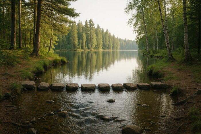
The route starts at Itasca State Park in northern Minnesota, where the Mississippi flows out of Lake Itasca only about 18 feet wide and shallow enough to cross on a line of stepping stones. It is a short walk from the parking area and one of the most satisfying starting points of any American road trip.
From there, the river loops north and east through lakes and forests before turning south to Minneapolis and St. Paul. In the Twin Cities, the Mississippi National River and Recreation Area, a unit of the National Park Service, protects about 72 miles of river corridor, with trails, overlooks and the falls that gave Minneapolis its mills.
The upper river: bluffs, eagles and Lake Pepin
South of the Twin Cities, the river runs between high wooded bluffs, and the scenery changes from farm country to a deep, wooded valley. Between Red Wing and Wabasha, the river widens into Lake Pepin, about 21 miles long and the widest naturally occurring part of the Mississippi, formed where the Chippewa River’s delta backs up the water. You can drive the Minnesota shore one way and the Wisconsin shore on the return.
In Wabasha, the National Eagle Center explains why bald eagles gather here: the water below the Chippewa confluence stays open in winter, so the birds can fish when the rest of the river freezes. Farther south, Effigy Mounds National Monument near Harpers Ferry, Iowa, preserves 206 Native American mounds, 31 of them shaped like animals such as bears and birds, on bluffs above the river.
Dubuque, Iowa, is a good overnight stop. Its National Mississippi River Museum and Aquarium became the first river museum affiliated with the Smithsonian, in 2002, and is the best place on the route to learn about the river’s wildlife, boats and history.
The middle river: Hannibal, the confluences and St. Louis
In Missouri, Hannibal is Mark Twain’s boyhood town. The Mark Twain Boyhood Home and Museum is a complex of nine properties, including his childhood home and the houses associated with the real people behind Becky Thatcher and Huckleberry Finn.
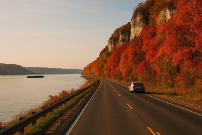
North of St. Louis, on the Illinois side, the Meeting of the Great Rivers National Scenic Byway runs about 33 miles through Alton, Elsah and Grafton, between the mouths of the Missouri and Illinois rivers, and ends at Pere Marquette State Park. The road runs at the foot of limestone bluffs and is especially good in fall. Note that the road near Grafton can close during river floods, with a signed detour.
In St. Louis, a tram carries visitors to the top of the 630-foot Gateway Arch, in Gateway Arch National Park. Farther south, at Cairo, Illinois, Fort Defiance State Park sits at the point where the Ohio River meets the Mississippi, one of the great river confluences in the world, with a viewing platform over the two rivers.
The lower river: the Delta to the Gulf
South of Memphis, the road enters the Mississippi Delta, flat farmland known worldwide as the birthplace of the blues. In Clarksdale, the Delta Blues Museum, founded in 1979 and housed since 1999 in a 1918 freight depot, holds the cabin where Muddy Waters grew up.
Vicksburg National Military Park preserves the site of the 1863 Civil War siege, with a 16-mile tour road past monuments, trenches and the restored Union gunboat USS Cairo; allow at least two hours. Natchez, with its antebellum homes, is the southern end of the 444-mile Natchez Trace Parkway, a tempting side trip toward Nashville.
In Louisiana, the road passes Baton Rouge and New Orleans, where most travelers end the trip. The Great River Road itself continues about 77 miles south of New Orleans to Venice, the last community on the river you can reach by car.
When to drive the Great River Road
- Fall: the best season for the upper river. Color usually peaks in early to mid-October around Red Wing and later in October into early November around Alton and Grafton.
- Winter: eagle season, from late December to early March, peaking in January and February. The upper route is cold and some small attractions close.
- Spring: high water can close low-lying sections, especially in Illinois and Missouri. Check state highway websites before you go.
- Summer: good for the northern states; the Delta and Louisiana are hot and humid.
Along the route, a network of about 90 Great River Road Interpretive Centers, from museums to visitor centers, gives you regular stops with local information. For other long drives, compare the options in our guide to the best scenic road trips in the USA, or browse our road trip ideas by region and season.
Great River Road FAQ
How long is the Great River Road?
Sources differ: about 2,069 miles according to the Federal Highway Administration, and some 3,000 miles according to the route’s promoters, who count roads on both banks.
Where does the Great River Road start and end?
It starts at Itasca State Park in Minnesota, at the source of the Mississippi, and ends at Venice, Louisiana, near the Gulf of Mexico.
How many days do you need to drive the Great River Road?
At least six days of driving, but ten days to two weeks is a better pace. Many travelers drive one section at a time instead.
How do you follow the Great River Road?
Look for the green pilot’s wheel signs, and use a map, since the route switches between roads and sides of the river.