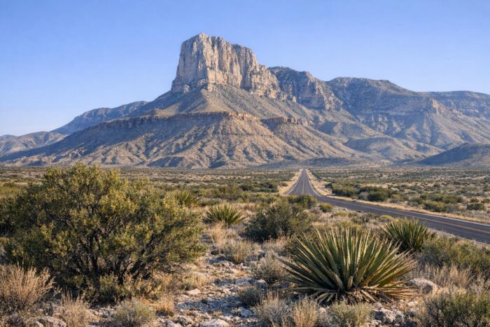
Guadalupe Mountains National Park guards the highest point in Texas and one of the best-preserved fossil reefs on the planet, yet it remains one of the quietest parks in the system, with about 206,000 visits in 2025. It sits on US 62/180 in far West Texas, right below the New Mexico line, and most travelers see it only as the cliff of El Capitan through the windshield.
Stop instead. Two experiences make the detour worth it: the climb to Guadalupe Peak and a fall walk into McKittrick Canyon. Both are covered below, along with fees and how the park fits into a West Texas road trip.
Guadalupe Mountains National Park at a glance
| Item | Details |
|---|---|
| Location | West Texas, on US 62/180, about 90 miles east of El Paso |
| Established | September 30, 1972 |
| Size | 86,367 acres |
| Highest point | Guadalupe Peak, 8,751 feet, the top of Texas |
| Entrance fee | $10 per person 16 and older, valid up to 7 days |
| Park annual pass | $35, up to four adults in one vehicle |
An ancient reef in the desert
The Guadalupe Mountains are built largely from the Capitan Reef, which grew along the edge of a shallow sea in the Permian period, long before the dinosaurs. Today that reef stands thousands of feet above the Chihuahuan Desert. El Capitan, the sheer limestone prow at the southern tip of the range, is the landmark you see for miles as you approach from El Paso.
There are no scenic drives through the high country here. The park is a hiker’s park: roads stop at the edges, and trails do the rest. That keeps it quiet, but it also means you need to plan your day around a trail rather than a road.
Hiking Guadalupe Peak
The Guadalupe Peak Trail starts at the Pine Springs Trailhead, near the visitor center. The park rates it very strenuous: 8.4 miles round trip with about 3,000 feet of elevation gain, and the steepest part comes in the first 1.5 miles. Most hikers need six to eight hours.
- Start early. You want to be off the summit well before afternoon heat or storms.
- Expect wind. Gusts on the upper ridges can be strong, especially in winter and spring.
- Carry plenty of water. There is none on the trail.
- Do not expect fall foliage. The park notes that little to no fall color is visible on this trail.
The reward at the top is a view over the salt flats to the west and El Capitan just below, the best in Texas by simple geography.
McKittrick Canyon in the fall
For fall color, go to McKittrick Canyon, about 7 miles north of Pine Springs on US 62/180. Bigtooth maples, oaks and other trees along the canyon’s spring-fed stream turn red and gold from mid-October to mid-November, with the best color usually in late October or early November.
| Destination from McKittrick Canyon Trailhead | Round trip |
|---|---|
| Pratt Cabin | 4.6 miles |
| The Grotto | 6.8 miles |
The canyon is day use only, from 8 a.m. to 5 p.m. Mountain Time, and the gate on the highway is locked each evening. Parking is limited, and it is not unusual for the lot to fill on fall color weekends, so arrive at opening or come on a weekday.
Other short options from the park’s trailheads include Smith Spring, an easy loop of about 2.3 miles from Frijole Ranch, and Devil’s Hall, a 4.2-mile round trip with rock scrambling from Pine Springs.
Between Big Bend and Carlsbad
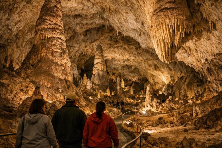
The Guadalupe Mountains sit in a sweet spot on a desert road trip. To the south, Big Bend and its Rio Grande canyons are a long day’s drive away. To the north, Carlsbad Caverns is only about 25 miles up the road in New Mexico. Spending a night in the area lets you hike one day and go underground the next, then continue west toward White Sands.
Services in the park are minimal, so arrive with a full tank and food for the day. If you are still deciding which parks deserve the miles, our overview of America’s must-see parks compares the main options by region and season.
Practical tips
- Stop at Pine Springs first. The visitor center is next to the main trailhead and is the place to check trail and weather conditions.
- Pay attention to the clock. The park keeps Mountain Time, and the McKittrick Canyon gate closes at 5 p.m. sharp.
- Bring layers. Temperatures on the high trails can be much colder and windier than at the trailhead.
- Watch your step. Rattlesnakes, century plants and prickly pear all share the trails in the desert sections.
When to visit
- Late October to mid-November: McKittrick Canyon color and mild hiking weather. Expect full parking at McKittrick on weekends.
- Winter and spring: cool, clear days, but strong winds on the high trails.
- Summer: hot at low elevations, so hike Guadalupe Peak at first light.
Guadalupe Mountains National Park FAQ
How hard is the Guadalupe Peak hike?
Very strenuous: 8.4 miles round trip with 3,000 feet of gain. Most hikers need six to eight hours.
How much is the entrance fee?
$10 per person aged 16 and older, valid for up to seven days. Children under 16 are free.
When is McKittrick Canyon at its best?
Usually in late October or early November, within a fall color window from mid-October to mid-November.
How far is Carlsbad Caverns from the Guadalupe Mountains?
About 25 miles to the north, just across the New Mexico state line.