Great Smoky Mountains National Park straddles the Tennessee and North Carolina border, and it is the most visited national park in the country: more than 11.5 million visits were recorded in 2025. Most of that traffic comes by car, and the park rewards drivers. One main road crosses the mountains, a one-way loop circles a historic valley, and dozens of pullouts open onto ridge after blue ridge.
There is no entrance fee, but you do need a parking tag. This guide covers the two drives that matter most, how to approach the park from Gatlinburg or Cherokee, when to come for fall color and how many days to plan.
Great Smoky Mountains National Park at a glance
| Item | Details |
|---|---|
| States | Tennessee and North Carolina |
| Size | 522,419 acres |
| Established | 1934, dedicated in 1940 |
| Entrance fee | None |
| Parking tag | $5 daily, $15 weekly, $40 annual |
| Main gateways | Gatlinburg and Townsend (TN), Cherokee (NC) |
| Elevation range | About 875 feet to 6,643 feet at Kuwohi |
| Average road speed | About 35 mph on most paved park roads |
The parking tag: what it is and who needs it
The park itself is free to enter. Instead, every vehicle that parks for more than 15 minutes anywhere inside the park needs a parking tag. The park is clear that the tag is not an entrance fee: you can drive straight through on Newfound Gap Road without one, but the moment you stop at a trailhead, an overlook lot or Cades Cove for longer than a quick photo, you need it.
- Daily tag: $5
- Weekly tag: $15, good for seven consecutive days
- Annual tag: $40
Tags are not tied to a single location, so one tag covers every lot in the park. On the federal free entrance days listed on the park’s fees page, tags are not required.
Newfound Gap Road: the drive across the Smokies
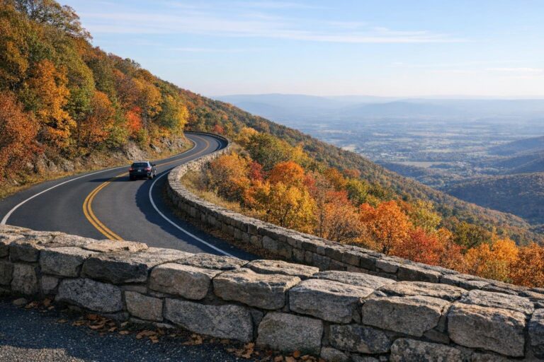
Newfound Gap Road carries US 441 for about 31 miles between Gatlinburg, Tennessee, and Cherokee, North Carolina. It is the only road that crosses the whole park, and it climbs from low hardwood forest to Newfound Gap at about 5,046 feet, the lowest drivable pass through the range. The state line runs right through the parking area at the gap, along with the Appalachian Trail, and the Rockefeller Memorial marks the spot where President Franklin D. Roosevelt dedicated the park in 1940.
With park roads averaging around 35 mph and plenty of pullouts, plan half a day with these highlights:
- Sugarlands Visitor Center at the Tennessee end, just outside Gatlinburg, for maps, the latest road status and tags.
- Newfound Gap for the state line view and a short walk on the Appalachian Trail.
- Kuwohi, formerly Clingmans Dome, reached by a 7-mile spur road from near the gap. At 6,643 feet it is the highest point in the park, with an observation tower at the end of a steep paved path. The spur road closes to cars in winter, and its lot often fills by midday in summer and fall.
- Oconaluftee at the North Carolina end, near Cherokee, with its open fields where elk are often seen at dawn and dusk.
Temperatures at the gap run much cooler than in the valleys, and rain in Gatlinburg can fall as snow on top. Newfound Gap Road stays open year round except during and just after winter storms, so check the park’s road conditions page between November and March before committing to the crossing.
Cades Cove: the 11-mile loop
Cades Cove is a broad valley on the western, Tennessee side of the park, reached from Gatlinburg by Little River Road or more directly from Townsend. An 11-mile, one-way loop road circles it past preserved log cabins, churches and a working gristmill. Cable Mill, near the halfway point, runs daily from mid-March through late November in 2026.
The loop is open from sunrise to sunset. The park suggests allowing at least two to four hours, more if you walk any of the trails, and on fall weekends a slow line of cars can stretch that further because traffic stops for every black bear sighting. Two tips help:
- Go early. Arriving at sunrise means cooler air, better light on the meadows and the best chance of seeing deer and turkeys.
- Know the vehicle-free days. The loop closes to cars on Wednesdays, typically from May through September, so cyclists and walkers have it to themselves. If you are driving, pick another day.
Approaching the park from Gatlinburg
Most first-time visitors base themselves in Gatlinburg, Tennessee, which sits directly at the park’s northern entrance on US 441. From the town you can be at Sugarlands Visitor Center in a few minutes, on Newfound Gap Road right after, and on Little River Road toward Cades Cove without backtracking. The Roaring Fork Motor Nature Trail, a narrow, winding one-way road past old homesites and cascades, also starts on the edge of town.
The trade-off is traffic. US 441 through Gatlinburg and the park entrance can back up badly on summer and October weekends, and the park warns that travel times in October can run hours longer than usual. Townsend, on the quieter western side, is a good alternative if Cades Cove is your priority, and Cherokee makes sense if you arrive from the Blue Ridge Parkway or the south.
Fall colors in the Smokies
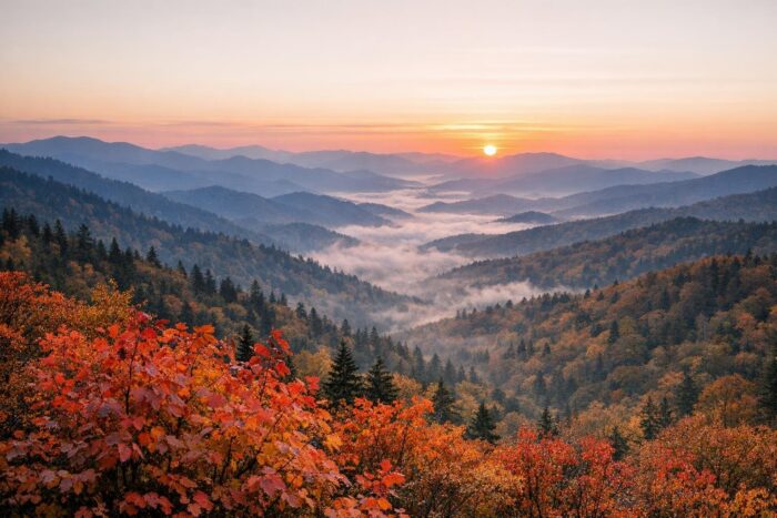
Fall color in the Smokies starts at the top and works its way down. At the highest elevations, leaves can begin to turn as early as mid-September. From early to mid-October, color develops above about 4,000 feet, so Kuwohi and the upper stretch of Newfound Gap Road peak first. Lower and middle elevations, including Cades Cove and the valleys around Gatlinburg and Cherokee, usually peak between mid-October and early November.
That long window is the park’s great advantage: if you miss the color up high, drive down. It also explains the crowds, since October is the busiest month of the year. To enjoy it:
- Plan your scenic drives on weekdays and start them early.
- Buy a weekly tag if you are staying more than two days.
- Check the road status before heading up to Kuwohi or the gap, as early cold snaps happen.
How many days to spend in Great Smoky Mountains National Park
| Time available | What fits |
|---|---|
| 1 day | Newfound Gap Road with Kuwohi, or Cades Cove at sunrise plus Little River Road |
| 2 days | Day one on Newfound Gap Road and Kuwohi, day two in Cades Cove and on the Roaring Fork Motor Nature Trail |
| 3 to 4 days | All of the above plus a waterfall hike, the Oconaluftee side near Cherokee and time to wait out fog or crowds |
Two full days cover the main drives comfortably. Three or four are better in October or if you want to hike, because weather in the high country changes fast and a cloudy morning at the gap can turn clear by afternoon.
Fitting the Smokies into a longer road trip
The park sits at the southern end of the Blue Ridge Parkway, which runs north to Shenandoah National Park in Virginia, so many travelers combine the two on one Appalachian drive. To the northwest, Mammoth Cave in Kentucky is a natural stop for anyone arriving from the Midwest. If you are building a bigger itinerary across several regions, our overview of the greatest national parks in America groups the parks by region with their scenic access roads and best seasons.
Great Smoky Mountains FAQ
Does Great Smoky Mountains National Park charge an entrance fee?
No. Entry is free, but any vehicle parked for more than 15 minutes needs a parking tag: $5 a day, $15 a week or $40 a year.
Is Smoky Mountain National Park the same as Great Smoky Mountains?
Yes. “Smoky Mountain National Park” and “Smoky Mountains National Park” are common shorthand for Great Smoky Mountains National Park, the official name.
Can I drive Cades Cove any day?
Most days, from sunrise to sunset. The loop is closed to vehicles on Wednesdays, typically from May through September.
When is peak fall color near Gatlinburg?
The valleys around Gatlinburg usually peak between mid-October and early November, a couple of weeks after the high elevations along Newfound Gap Road and Kuwohi.