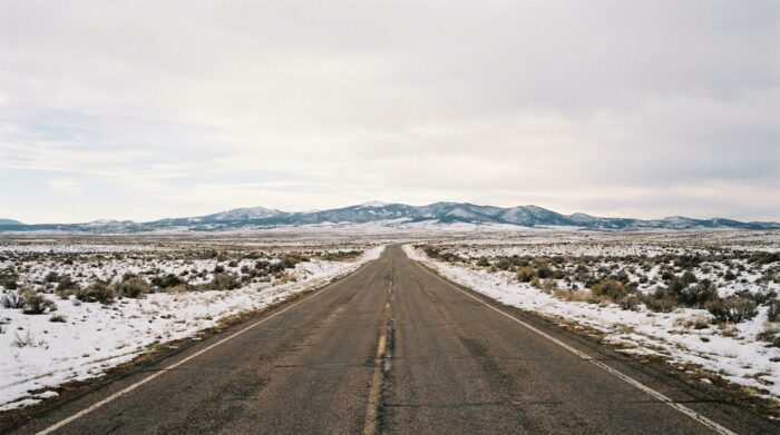
In winter, driving conditions along Route 66 vary by region. Cold, snow and ice can complicate the trip, especially in the Midwest and at higher elevations in the West. When planning your trip, allow for stops you can shorten or reschedule, and check the weather and road conditions before each departure.
Adjust your stops to the day’s conditions
Avoid building a winter itinerary around fixed driving days. Snow or ice can change how long it takes to reach your next stop, and some sections may become difficult to travel. Leave room in your schedule to delay a departure or shorten the distance you plan to cover.
In New Mexico, changes in elevation can quickly affect driving conditions. The National Weather Service de Chicago does not provide current conditions for all of Route 66, but its climate normals offer a reference for the Chicago area. For current local conditions, check official forecasts and road information for the section you plan to drive.
Do not drive a section if authorities advise against travel. If a poor forecast threatens your planned stop, postpone the trip rather than counting on conditions to improve quickly.
What to expect from Chicago to the West
In Chicago, the average January temperature is 25.2°F, or about −3.8°C, according to the National Weather Service’s 1991-2020 climate normals. The city averages 28.1 days a year when the low temperature reaches 32°F or below. These figures describe average climate conditions, not the weather on a particular day.
Farther west, terrain and elevation can make conditions changeable. The National Weather Service in Albuquerque specifically identifies Clines Corners, Tijeras Canyon, the Continental Divide and Raton Pass as areas where motorists can become stranded in difficult conditions. Check local forecasts and road conditions before entering these sections.
The Texas Panhandle can also experience snow, high winds and rapid temperature changes. At Petrified Forest in northeastern Arizona, snow and rain can occur in winter, sometimes from October through March. These differences make plans based on identical conditions from state to state unreliable.
How to check the weather and road access
Before each departure, check official forecasts for your current location and your next stop. Also check road conditions with transportation authorities. A regional forecast may not accurately describe a higher-elevation stretch or an area exposed to different conditions.
In New Mexico, pay particular attention to elevation changes and areas flagged by the National Weather Service. At Petrified Forest, check park updates before you go. The National Park Service says the park’s opening may be delayed in winter until its roads are considered safe.
The park also describes cold winter nights and days that warm up in the sun. Average overnight temperatures are often in the 10s and 20s°F, while daytime highs are in the 40s or 50s°F. Plan for conditions to differ between the start and end of the day, and do not assume the road will be passable just because the sky is clear.
What should you expect when visiting Petrified Forest?
A visit to Petrified Forest depends on both the weather and whether the park roads are open. Snow can melt quickly, but snow or rain is still possible during winter. Check park updates on the day of your visit, and have an alternative stop in mind in case access is delayed.
The average temperatures listed by the park are not a substitute for a current forecast. Instead, they help explain the possible difference between nighttime and daytime temperatures. If your plans include an early arrival or a late departure, check local conditions when planning that section of the trip.
Frequently asked questions
Is Route 66 drivable in winter?
Conditions are not uniform. Snow, ice and cold can affect some sections, and terrain can make driving more difficult in the West. Check forecasts and road conditions before each departure.
Which areas in New Mexico can be difficult to drive?
The National Weather Service lists Clines Corners, Tijeras Canyon, the Continental Divide and Raton Pass among the areas where motorists can become stranded in poor conditions.
Can it snow at Petrified Forest in winter?
Yes. The National Park Service says snow and rain can occur from October through March. The park’s opening may be delayed until the roads are safe.
What temperature should you expect in Chicago in January?
The average January temperature normal in Chicago is 25.2°F, or about −3.8°C. This climate average does not predict conditions on the day you travel.
How long should you plan to drive Route 66?
The sources cited do not give a travel time for the entire Route 66. In winter, weather and road conditions may also require changes to your planned stops.