A Route 66 map looks simple at first: one line running from Chicago to Santa Monica, bending southwest through eight states. Up close it is more complicated. The road was realigned many times between 1926 and 1985, so a single “correct” map does not exist, and some old segments now end in a field.
This guide walks you through the route in order, lists the key stops state by state, shows which interstates replaced it, and points out the historic stretches you can still drive today. Use it alongside a paper map or navigation app when you plan your own trip.
The Route 66 map in one sentence
US Route 66 ran from downtown Chicago southwest to St. Louis, across southern Missouri and a corner of Kansas, through Tulsa and Oklahoma City, across the Texas Panhandle, through Albuquerque and northern Arizona, and across the Mojave Desert to Los Angeles and Santa Monica. The original 1926 alignment measured 2,448 miles.
The eastern end is at Grant Park, near Michigan Avenue. The western end moved over time: the road first stopped in downtown Los Angeles, then was extended in the mid-1930s to the corner of Lincoln and Olympic Boulevards in Santa Monica. The famous End of the Trail sign on Santa Monica Pier is symbolic, but it is where almost every traveler finishes.
Route 66 route map, state by state
Here is the route in westbound order, with the towns most travelers use as markers when they read the map.
| State | Main towns in order |
|---|---|
| Illinois | Chicago, Joliet, Wilmington, Pontiac, Bloomington, Springfield, Litchfield |
| Missouri | St. Louis, Stanton, Rolla, Lebanon, Springfield, Carthage, Joplin |
| Kansas | Galena, Riverton, Baxter Springs |
| Oklahoma | Miami, Vinita, Catoosa, Tulsa, Stroud, Arcadia, Oklahoma City, Clinton, Elk City |
| Texas | Shamrock, Amarillo, Adrian |
| New Mexico | Tucumcari, Santa Rosa, Albuquerque, Grants, Gallup |
| Arizona | Holbrook, Winslow, Flagstaff, Williams, Seligman, Kingman, Oatman |
| California | Needles, Amboy, Barstow, Victorville, San Bernardino, Pasadena, Los Angeles, Santa Monica |
New Mexico has one quirk worth spotting on an old map. Before 1937, the road made a long loop north through Santa Fe before coming back down to Albuquerque. Later maps show a straighter line through Albuquerque, and both versions can be driven.
Which interstates follow the old road?
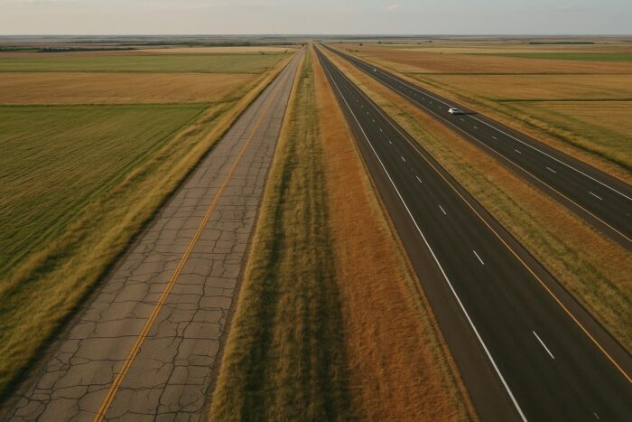
When you open a modern US Route 66 map, the easiest way to follow it is to find the interstates that replaced it. The old road usually runs beside them as a frontage road, a state highway or a business loop through town.
- I-55: Chicago to St. Louis.
- I-44: St. Louis to Oklahoma City.
- I-40: Oklahoma City to Barstow, the longest replacement.
- I-15 and I-10: the California approach into the Los Angeles area.
Knowing this helps when a historic segment dead-ends: you rejoin the interstate at the next exit and pick up the old road again a few miles later.
Historic sections you can still drive
Most of the route is still drivable in some form. These stretches stand out because the old road survives intact and the interstate is far enough away to feel quiet.
Illinois: the early alignments
Between Joliet and Springfield, the old road runs close to I-55 through small towns such as Wilmington, home of the Gemini Giant, and Pontiac. It is an easy first day that gets you used to reading the brown Historic Route 66 signs.
Kansas: all 13 miles
The whole Kansas section is drivable, from Galena to Baxter Springs, with the Rainbow Bridge over Brush Creek near Riverton in between.
Oklahoma: Tulsa to Oklahoma City
The two-lane road through Sapulpa, Stroud, Chandler and Arcadia is a favorite, with the Rock Cafe in Stroud and Pops in Arcadia along the way.
Arizona: Seligman to Kingman and the Oatman road
The longest continuous stretch of the old highway runs from Seligman through Peach Springs and Hackberry to Kingman. West of Kingman, the road climbs over Sitgreaves Pass to Oatman on sharp curves. Take it slowly, and avoid it after dark or with a large RV.
California: the Mojave
East of Barstow, the old road through Amboy crosses real desert, past Roy’s Motel and Cafe. Services are scarce, so fill up and carry water before you leave the interstate.
How to use a map of Route 66 when planning
A good plan combines three tools. First, a large overview map of the United States to see the whole line and split it into days. Second, a turn-by-turn Route 66 guidebook or state-by-state map, because navigation apps usually push you back onto the interstate. Third, your phone for real-time traffic, closures and opening hours.
Mark your overnight stops first, then the must-see sights between them, and only then decide which old segments to add. For timing, budget and a day-by-day plan, read our Route 66 road trip guide, which turns this map into a two-week itinerary. And if you want to compare the Mother Road with other famous drives, see America’s classic scenic routes.
Route 66 map FAQ
Where does Route 66 start and end on the map?
It starts in downtown Chicago near Grant Park and ends in Santa Monica, California. The End of the Trail sign stands on Santa Monica Pier.
Which states does Route 66 cross?
Eight: Illinois, Missouri, Kansas, Oklahoma, Texas, New Mexico, Arizona and California.
Do navigation apps show Route 66?
Navigation apps show many segments by name, but they tend to route you onto the faster interstate. Adding waypoints on the old road or using a dedicated guidebook keeps you on the historic alignment.
Why do Route 66 maps disagree with each other?
Because the road was rerouted several times over nearly 60 years. Maps may show the 1926 alignment, a later one, or a mix of both.